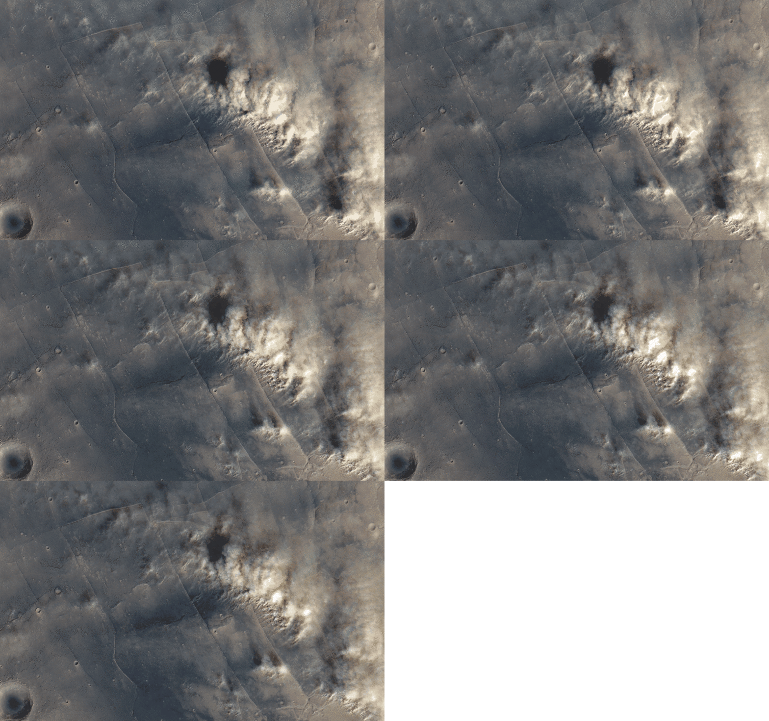
Dust stom over Tempe Terra, Mars
ESA / DLR / FU Berlin (G. Neukum) / Justin Cowart
Still images of Mars often give us a false impression that Mars is a dead planet, with nothing going on other than the occasional dust storm. Do a quick image search for Mars and most of the results are mosaics designed to show Martian geography, not meteorology. But these images don’t tell the planet’s full story. Martian weather is dynamic, with water ice cloud streets forming around the polar areas, cold fronts pushing through the midlatitudes and raising dust storms, and thin hazes forming as air flows around topographic obstacles like volcanoes and crater rims.
No space agency has deployed a dedicated weather satellite to Mars, so we can’t watch these systems form and move across the surface like we can with the spectacular images of Earth returned by satellites like Himawari-8. In fact, the only instrument dedicated to monitoring Martian weather, the Mars Color Imager (MARCI) onboard the Mars Reconnaissance Orbiter, can only image a location on the Martian surface once per day (with the exception of some areas near the poles).
Fortunately for Martian weather enthusiasts, there is a way to get a glimpse of weather in action at the Martian surface. The High Resolution Stereo Colour Imager (HRSC) instrument onboard Mars Express was designed to produce stereographic color maps of Mars. To do this, HRSC uses a set of 9 pushbroom sensors. Four of these sensors image the surface in color at blue, green, red, and near-IR wavelengths. The other five collect stereo and photometric data using broadband filters that cover the same roughly the same spectral range. The sensors are mounted at different angles, looking between 20 degrees ahead and behind the spacecraft. Parallax from the five different viewing angles allows mission scientists to create DEMs of the surface with 10 to 15 meter vertical resolution.
That’s the intended purpose, anyway. The offset viewing angles for the sensors onboard the spacecraft allow for something else: time-lapse images. The imaging setup means that the first imaging channel sees the surface about 70 seconds before the last. If the wind is blowing at the surface, the time between sequential images is just long enough that the motion of dust clouds is visible. If clouds are at higher altitude, then the parallax also shows up as motion. The color data can then be overlain to colorize the scene.

